Category Archives: Research Updates

Greenland Fjords Research on the RV Tarajoq

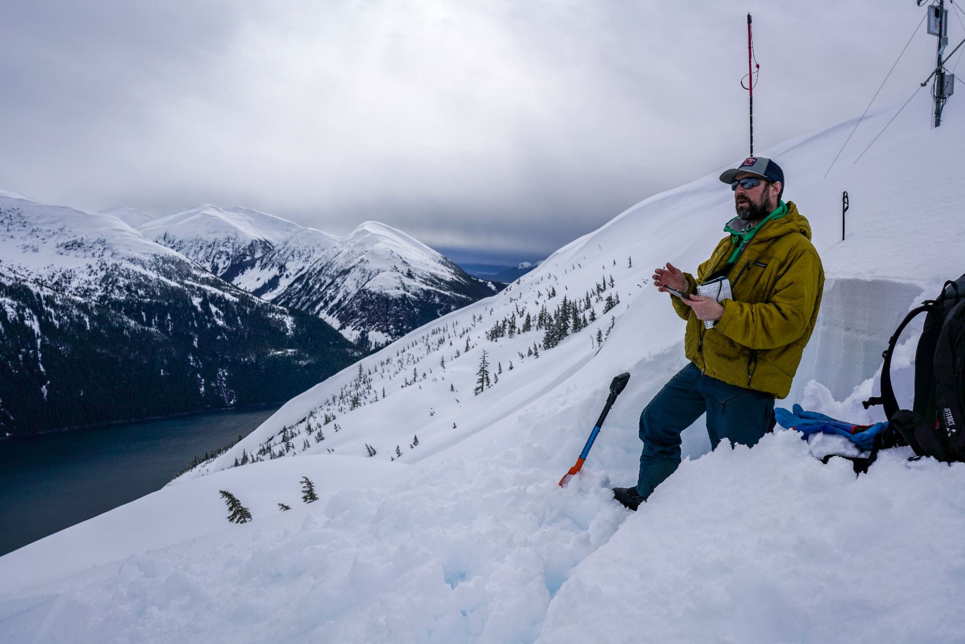
Mark Carey joined the rest of his multidisciplinary Navigating the New Arctic (NNA) research team for ice-ocean-society research in east Greenland during August 2023. Their project, funded by the National Science Foundation’s NNA program, is called “Global changes, local impacts: Study of glacial fjords, ecosystems and communities in Greenland.” A recent article in Oceanography gives an overview of the project that runs through 2026, while the August 2023 NNA Newsletter explains the research activities.

This summer was the first time they jointly conducted fieldwork together. Being on the ship together for more than two weeks solidified the group and inspired many conversations about collaboration, interdisciplinary research, and connections with communities and Greenlandic partners.

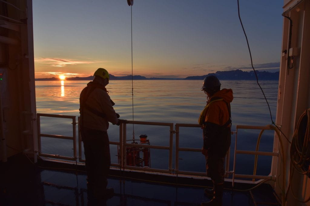
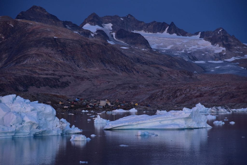
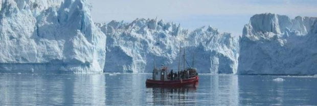
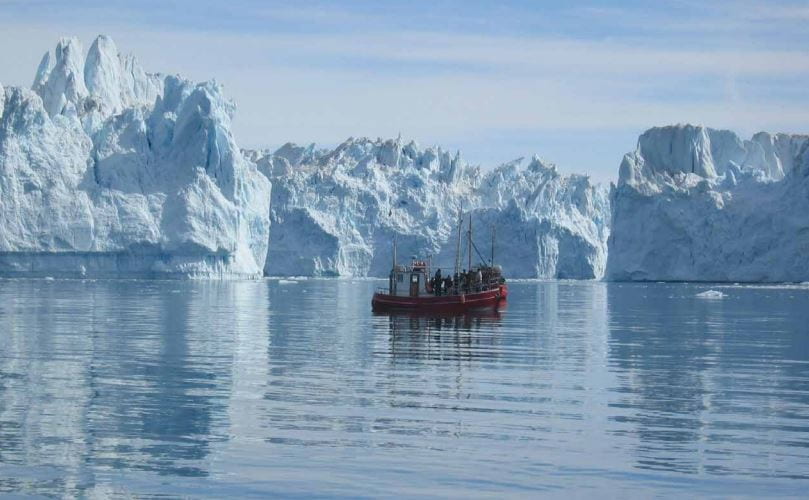
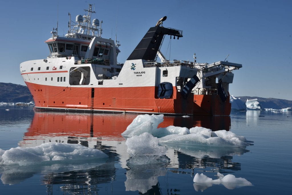
They set sail in early August from Reykjavik, Iceland, on the RV Tarajoq, an oceanographic and fisheries research vessel owned and operated by the Greenland Institute of Natural Resources. Their goal: study the Sermilik fjord system and the continental shelf ocean through multidisciplinary approaches that involved collaboration across the team of physical and biological oceanographers, fisheries biologists, glaciologists, climate modelers, and social scientists.

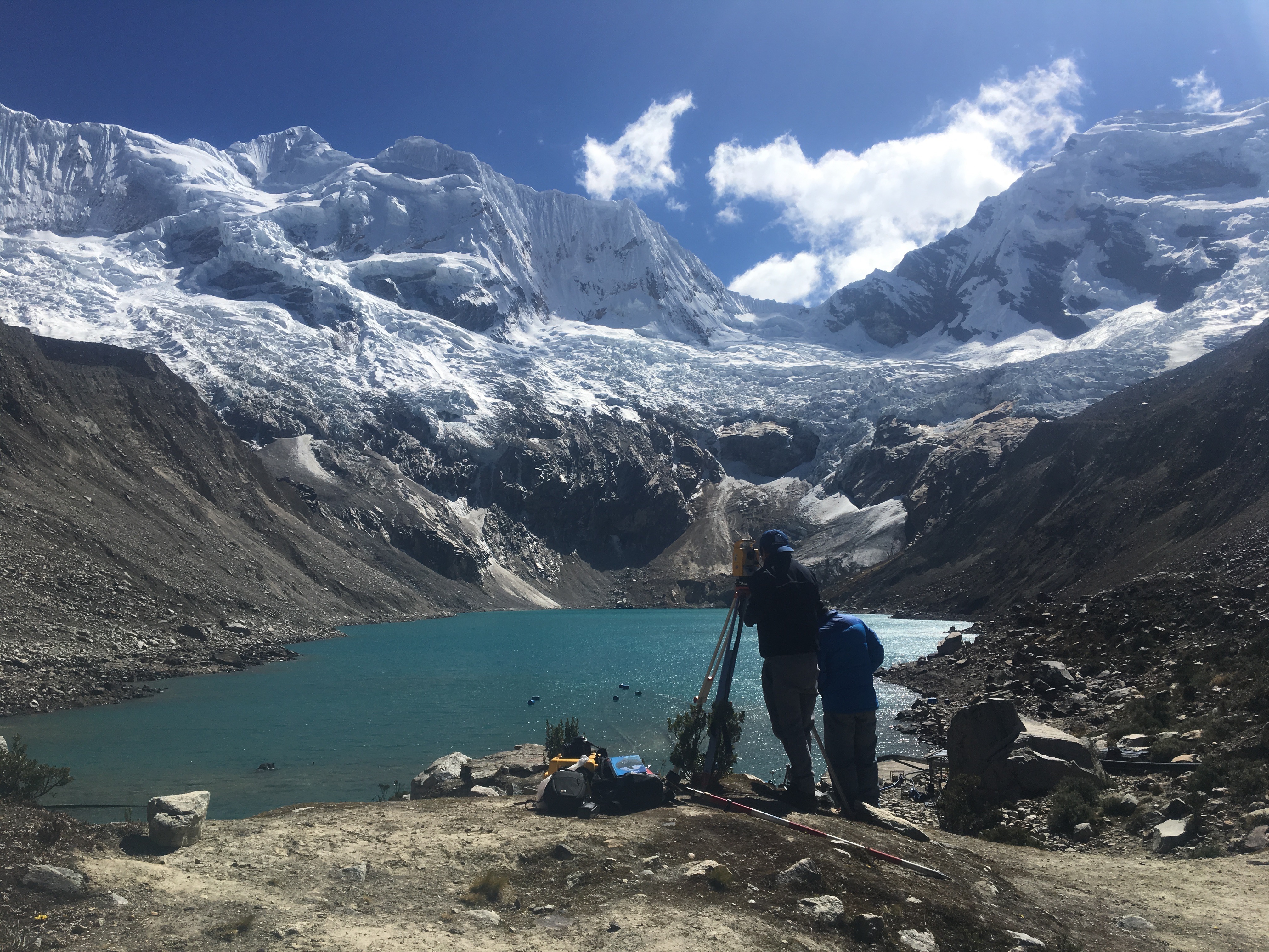
A principal goal of the cruise was scientific research to understand fjord dynamics, circulation, and human dimensions. For the last decade or so, scientists have come understand the way warm ocean water enters the fjords and melts the glacier outlets of the Greenland Ice Sheet. But fjord circulation is complex, and the team strives to understand life in the fjord as well as the physical system. This requires many disciplinary approaches. It also involved communication with and input from communities along the fjord, especially a schoolteacher from Tiilerilaaq.

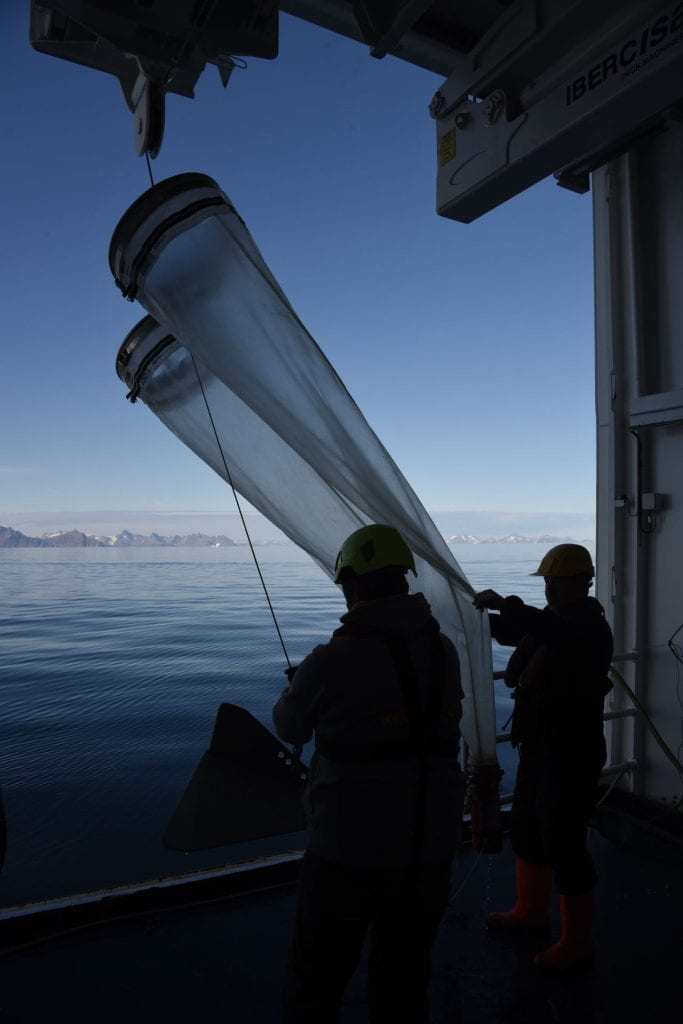
Another key objective was collaboration and building relationships through shared field research experiences. Carey has recently argued that multidisciplinary teams can thrive and improve research when they spend time together in the field, learn each other’s research methods, and share unstructured and informal times together that often spark some excellent collaborative ideas (see Alagona, Carey, and Howkins, 2023). On this Greenland cruise, Carey worked the noon to midnight shift on the ship, assisting with oceanographic data collection and learning new fields and research practices. The teamwork and shared experiences—and new friendships—has laid an ideal foundation for continued collaboration and fresh insights into the ice-ocean-society dynamics of the fjord system.


Carey will continue work on this project back at the UO, working closely with undergraduate Glacier Lab members Mira Cross and Olivia Black. They are focusing on fisheries policy and management, public perceptions of Greenland fjords, and the human drivers of change within fjords. Carey is working to build relationships with Greenlandic scholars and communities as well. After all, Greenland priorities and plans must ultimately shape the research. Next steps will thus involve on-the-ground learning in Greenland and from Greenlanders, with the goal of further expanding collaboration beyond the terrific current partners at the Greenland Institute of Natural Resources.

Research in the Avalanche Capital

Fieldwork report by Environmental Studies PhD candidate and Glacier Lab member Zac Provant.

When I arrived in Juneau on March 11th, 2022, winter disasters were on people’s minds. In December 2020, Haines, Alaska experienced a deadly landslide that destroyed houses and killed two people. In February 2021, neighborhoods in downtown Juneau were evacuated due to extreme risk of historic avalanches. On March 24th, 2022—while I was in Juneau studying avalanches—Anchorage was hit by a massive avalanche that left debris as deep as 80 feet between houses and across roads.

This ongoing attention to winter hazards in Alaska reflects a longstanding awareness that Alaskan mountain ranges are dangerous places to live. In Juneau, people have a particularly infamous relationship with avalanches and landslides. For decades, news reporters and scientists have spread stories of disaster: National Geographic Magazine called Juneau “the nation’s worst risk for an avalanche disaster”, and in the 1950’s avalanche science legend Ed LaChapelle kicked off the decadal cycle of experts recommending no more development in certain parts of downtown Juneau. As Tom MatticeJuneau’s Emergency Operations Managerdescribed in an interview with local news, avalanche scientists visiting Juneau all say the same thing: “we can’t believe you built here.

Image 1. A natural avalanche barreling down the Behrends avalanche path. These slides occur every year, often coming within 100 meters of houses. An avalanche large enough to damage houses has not occurred since 1962. Image from the City and Borough of Juneau.

As visualized in the image above, Juneau’s concern for avalanche and landslide risk is not simply a detached fear of potential destruction based on expert opinions, avalanche forecasts, or over-protective regulations. There have been hundreds of dangerous avalanches in Juneau since it was developed as Alaska’s first mining town in the late 19th century. A document buried in a City and Borough of Juneau (CBJ) file cabinet lists many of these events, with the first recorded avalanche wiping out 3 cabins in 1887 and the well-known 1962 avalanche on the Behrends path destroying “numerous buildings, vehicles, and trees.” Many currents residents also have a clear memory of the 2008 avalanche that destroyed Alaska Electric Light and Power facilities and caused an energy crisis lasting nearly six months. A resident of a downtown hazard zone told me she paid over $3000 for electricity alone over that six-month period—a cost her family really couldn’t afford. This same woman had to evacuate her home in 2021, and she showed me her own recent cellphone video of an avalanche flying down the mountain to fully cover Thane Road. To her—and to everyone I spoke with in Juneau—deadly avalanches and landslides aren’t an abstract, back-of-mind risk like the Cascadia earthquake or the Yellowstone eruption. These winter hazards are a part of Juneau’s history, and this history plays an important role in residents’ everyday experiences. 

In response to this long history of environmental disaster, local news stations, city officials, and avalanche experts have worked through various options for hazard mitigation in Juneau. This includes special avalanche and landslide property insurance, development and zoning regulations, avalanche forecasting, engineering projects, and home buyouts. The CBJ engages all of these mitigation options except home buyouts, which Tom Mattice tells me won’t realistically happen until another massive avalanche ends in tragedy. Residents in high hazard zones like the Behrends neighborhood and White subdivision have additional forms of insurance, the CBJ has regulations for property development in hazard zones, organizations like the Department of Transportation and Alaska Electric Light and Power employ their own private avalanche forecasters, and engineering projects are repeatedly proposed and constructed to protect public and private property. 

Image 2. This current official avalanche and landslide hazard map was adopted in 1987 and is based on science from the 1970’s. There have been multiple attempts to update the downtown hazard maps, but these newer maps have not been adopted due to concerns about increased development regulations, property values, and insurance premiums. Image from the City and Borough of Juneau.

Image 3. Mike, Alaska Electric Light & Power’s avalanche forecaster, digs a pit to check snow stability on a steep slope near the Snettisham Dam. There are powerline towers at risk of being destroyed by an avalanche, so AEL&P regularly tests snow stability during dangerous conditions and conducts avalanche mitigation if necessary (often using a helicopter and daisy bell). Image from Zac Provant.

Yet when people talk about hazards and hazard mitigation in Juneau, they often fail to contextualize how people actually experience avalanches and landslides as a part of their daily lives. Of course, people don’t experience hazards universally—a fact that is clearly demonstrated by the high risk of a deadly avalanche or landslide in multiple downtown zones and the impossibility of a slide a few miles away in the Mendenhall Valley. However, it is not just exposure to hazards that influences someone’s vulnerability. There are also significant differences in how people experience the impacts of avalanche and landslide risk, such as accessing insurance, navigating development regulations, comprehending hazard maps and avalanche forecasts, and absorbing the cost of damages or property value changes. An illuminating example of this can be found in Rebecca Elliot’s paper “Scarier than another storm“, which looks at how people experience NFIP flood rate insurance maps. In order to understand how the many forms of hazard mitigation will or won’t help keep people safe in Juneau, I believe that it is important to examine the often-overlooked impacts of hazard risk in people’s everyday lives.

Guided by scholarship in unnatural disasters and environmental justice, I see hazard vulnerability as being produced within a system rather than as a preexisting condition for marginalized people (see: Marino & Faas, 2020). My research therefore unpacks how actors and institutions in Juneau influence the way hazard vulnerability materializes within the city. Do the mitigation strategies for avalanche and landslide risk help some people while disadvantaging others? Do wealthier residents have different experiences with hazard risk given their access to engineering consultants, insurance options, and political power? How are the avalanche experts, local officials, and residents addressing climate change as a component of hazard risk and vulnerability?

My research trip to Juneau in March 2022 jumpstarted an exciting new stage for my dissertation fieldwork and data analysis. I left with a solid foundation of key research themes and thought-provoking stories. I conducted 17 informal interviews with residents, city officials, non-profit directors, and avalanche experts, and I collected hundreds of pages of unpublished documents on the history of avalanche and landslide management in Juneau. My next steps include remote interviews, document analysis, and of course more time in Juneau. I will continue to examine how people in hazard zones influence, are erased from, and are impacted by hazard mitigation stories and strategies. As climate hazards become more frequent and more severe—from hurricanes to heat waves to avalanches—I offer the overlapping projects of hazard mitigation and climate adaptation a new approach that helps contextualize how vulnerability is actually experienced in a local community.

New Research Collaboration and Interdisciplinary Team Teaching

Thanks to a new Williams Council Instructional Grant, Mark Carey will be teaming up with UO oceanographer Dave Sutherland (Earth Sciences and Environmental Studies) and UO literature scholar Casey Shoop (Clark Honors College) to conduct summer 2019 research together in Greenland and to co-teach a Spring 2020 course on “Arctic Icebergs.”  Their project will pilot innovative teaching practices while allowing students to examine how Arctic icebergs move from Greenland fjords to the global imagination. Through new courses, team-taught by these three professors (one each from the natural sciences, social sciences, and humanities), Arctic icebergs will be used as a case study for teaching about larger environmental issues. This problem-based teaching experiment will incubate first in the Clark Honors College and then scale up for the College of Arts and Sciences to focus on real-world scenarios and collaborative undergraduate research.  Team-teaching on Arctic Icebergs will complement Carey’s ongoing scholarship — including his nearly completed book — on the multifaceted and longstanding human experience with icebergs in the North Atlantic Ocean.

Research and Training on Climate Change and Society in the Andes

Lake Palcacocha, Sept. 2017. Photo by Holly Moulton.

This summer, Holly Moulton traveled to Peru for seven weeks to participate in research and training related to glacier melt, hydrologic variability and social aspects of climate change in the Peruvian Andes. Her first stop was the “International Social Science Forum: Interdisciplinary Dialogues on Climate Change, Disasters and Governance,” in Cusco, Peru. The conference was comprised of a multi-disciplinary and transnational group of professionals, academics, and members of civil society, who presented on issues related to climate change in high-mountain systems. Following the Social Science Forum, Holly traveled to Pisac to participate in the Winter School, a one-week training program sponsored by Proyecto Glaciares+ and the University of Zurich. The course provided background knowledge in integrated management of montane hydrologic resources to a team of diverse professionals. Following these experiences, Holly traveled to Huaraz, Peru to conduct research on social responses to climate change adaptations in the region, specifically related to flood hazards and water management at three glacial lakes. The work builds on more than 15 years of Cordillera Blanca glacier-society research conducted by Mark Carey and the Glacier Lab. This most recent work was conducted in collaboration with Mark and funded by a grant called Aguafuturo from the University of Zurich, Switzerland. Aguafuturo seeks to create an integrated social and technical risk management framework for climate change related hydrologic variability and adaptation measures in the high Andes.

These various experiences and research show definitively that trans-disciplinary approaches to climate change adaptation in the Peruvian Andes provide both challenges and opportunities for future research. Climate change adaptation is a complex and multi-faceted process that is affected by social, political and natural variables alike. Above all, integrated management of hydrologic resources is critical.  Reducing flood risks, for example, may be insufficient as the only goal of a public works project at a glacial lake, given the projected future scarcity of water in the Cordillera Blanca and the need to anticipate related challenges. In this way, it is necessary to understand both the social and technical aspects of and barriers to climate change adaptation and water resource shifts, both in the short and long term. The Glacier Lab researchers and the Aguafuturo team at the University of Zurich believe that their research in the Cordillera Blanca can also be useful for understanding challenges and opportunities for climate change adaptation in other glaciated mountain regions across the globe.

Alaska Field Report

By Andrea Willingham

One of my favorite things about being a part of the Glacier Lab is getting to contribute to the wildly diverse research conducted among its members.  This summer, I put my own research into practice and ventured to southeast Alaska to execute my field work for my Master’s project on Local and Traditional Ecological Knowledge (LEK/TEK) and science related to climate change. It was my first time conducting social science field work, and inevitably turned out to be an incredible learning experience in every way.  Continue reading